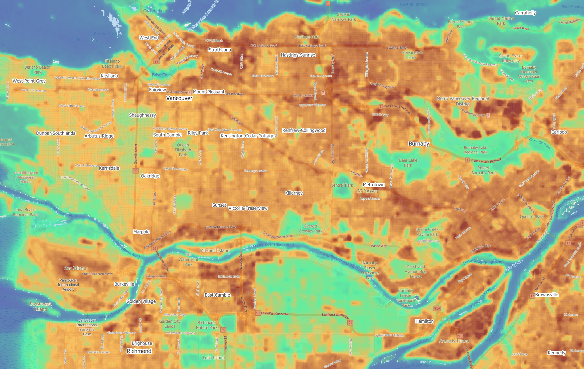
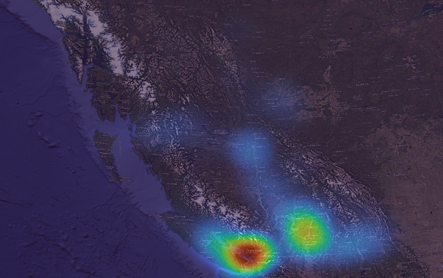
Climate Risk, Social Vulnerability, and Emergency Preparedness
Planovative leverages advanced GIS analytics, climate projections, and evidence-based
methodologies to evaluate community risk and strengthen resilience to extreme heat, flooding,
wildfire, and other hazards. We help municipalities and community-based organizations understand
how climate hazards intersect with social vulnerability and critical infrastructure, ensuring
equitable and informed planning outcomes. Through system development, interactive mapping, and
collaborative engagement, we design risk assessment tools and proactive emergency preparedness
strategies that protect people, services, and assets across Canada.
Complete Communities and Official Community Plan (OCP) Updates
Planovative supports long-range planning by developing multi-criteria decision-making frameworks
and updating Official Community Plans rooted in the principles of complete, connected, and resilient
communities. We help municipalities and non-profit organizations evaluate and align land use, housing, transportation,
infrastructure, and climate considerations using geospatial analysis, scenario testing, and policy
review to guide sustainable growth. Our team collaborates with staff, elected officials, and
community members to produce evidence-based strategies, maps, and implementation tools that reflect
local priorities, equity objectives, and long-term needs across diverse communities in Canada.
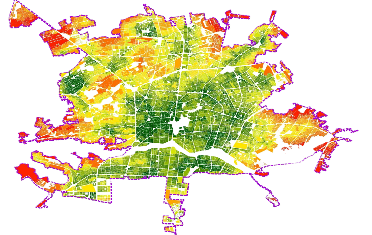
Social Service and Infrastructure Planning
Planovative applies advanced geospatial analytics, spatial accessibility modeling, and
equity-based statistical assessment to evaluate how communities access essential social
and public services. We identify service gaps, unmet needs, and structural barriers in
underserved areas by integrating demographic, socio-economic, mobility, and infrastructure
datasets. Our team develops data-driven decision-support frameworks that help municipalities
and community organizations prioritize investments, optimize service delivery, and plan
resilient, people-centered community infrastructure systems. Through technical expertise
and collaborative engagement, we strengthen equity, improve well-being, and support
sustainable long-term service networks across Canada.
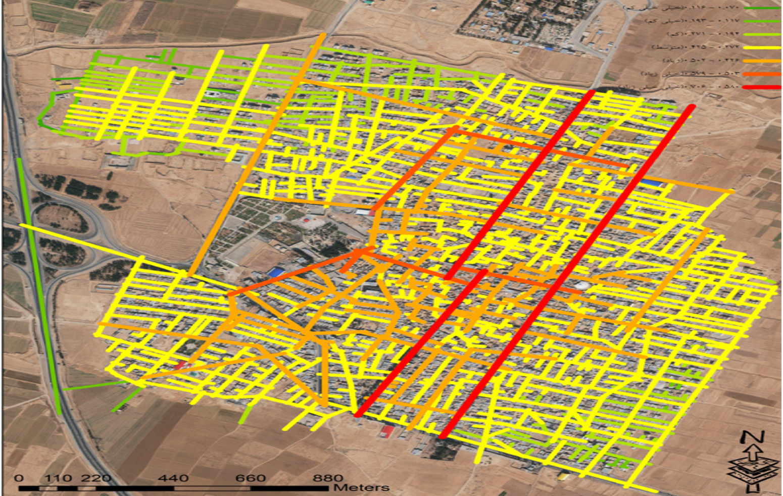
Mobility and Active Transportation
Planovative designs evidence-based mobility and active transportation plans that support
safe, sustainable, and equitable travel choices across communities. Using advanced
geospatial analytics, network modeling, artificial intelligence, machine learning, and
computer vision techniques, we evaluate and optimize multimodal transportation systems—
including public transit, walking, cycling, paratransit, and accessibility services. Our
team identifies infrastructure gaps, models future demand, and assesses the performance
and equity impacts of mobility networks to guide investment and policy decisions. Through
collaborative engagement, data-driven analysis, and scenario testing, we help
municipalities plan integrated, resilient, and people-centered transportation systems
that improve connectivity, reduce barriers, and enhance long-term community well-being.
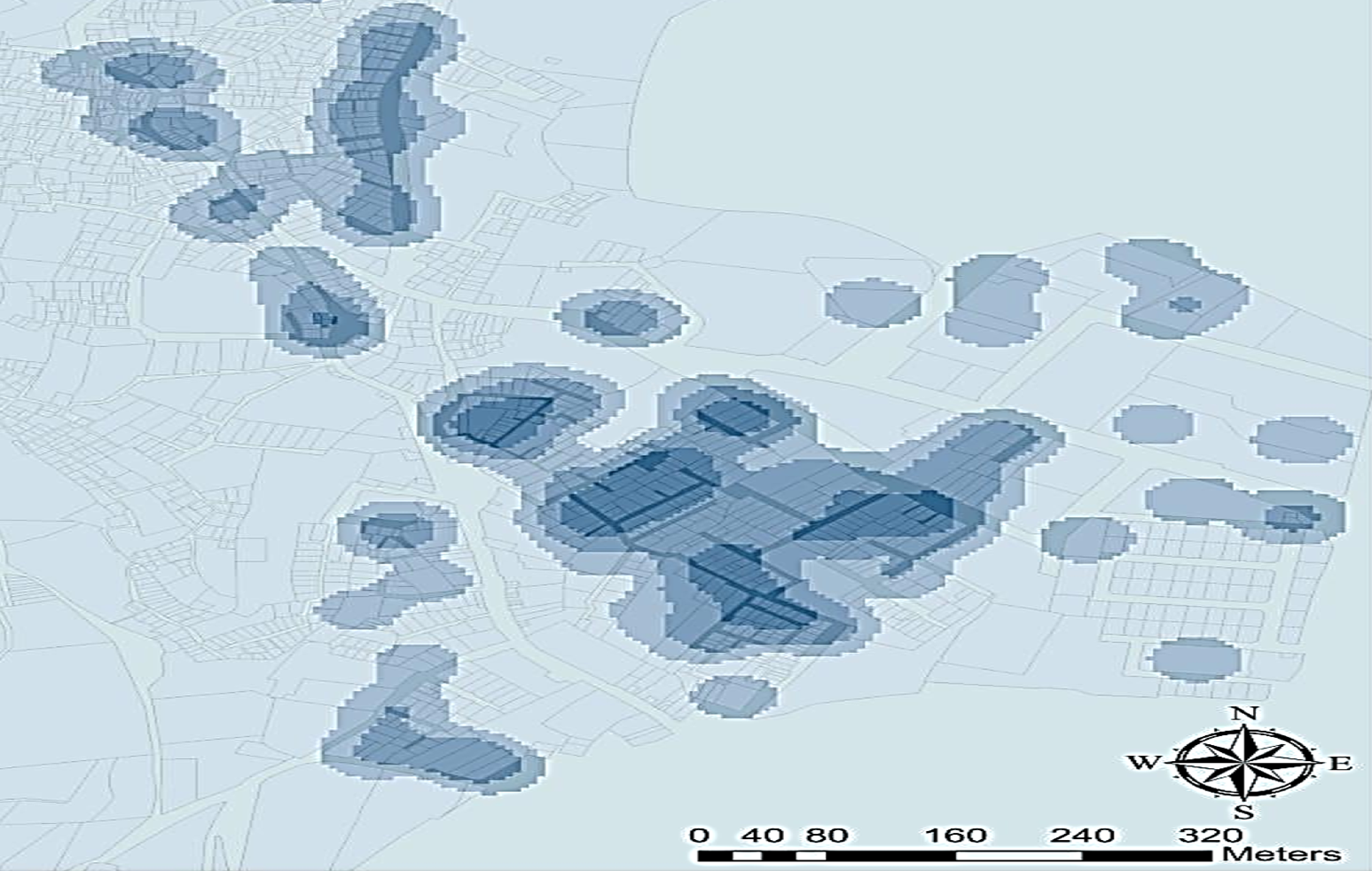
Suitability Analysis for Land Use, Housing and Business Development
Planovative delivers advanced land-use suitability and site selection analysis to support
housing (market and non-market), tourism, industrial, and business development decisions.
Using geospatial analytics and multi-criteria decision-making frameworks, we integrate policy
constraints, infrastructure capacity, environmental conditions, hazard risk, market access,
and community priorities to identify high-potential locations and reduce planning uncertainty.
Our work helps municipalities and organizations compare scenarios, evaluate trade-offs, and
prioritize investments with clear, defensible evidence. Through data-driven mapping,
decision-support tools, and collaborative engagement, we enable practical, equitable, and
sustainable growth strategies tailored to local context across Canada.
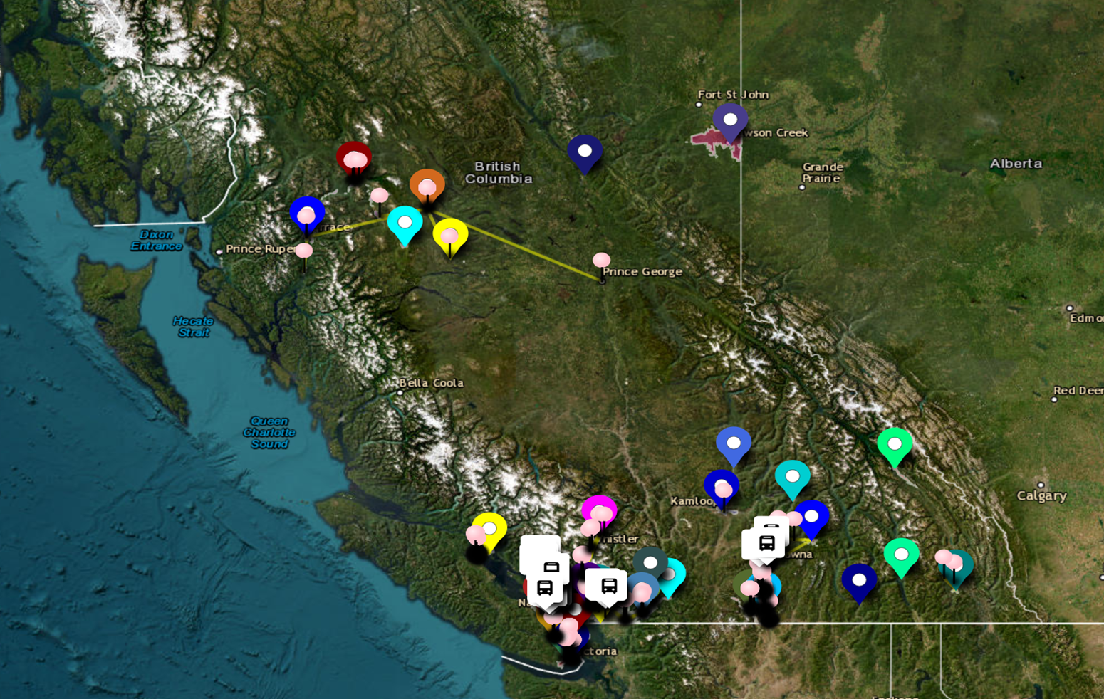
Participatory Mapping for Community Services and Funding Decisions
Planovative delivers participatory mapping projects that help community-based organizations,
funders, and partners collaboratively define service areas, identify community strengths and assets,
and surface opportunities, threats, and gaps. Using structured facilitation, human-centered engagement,
and geospatial technologies, we combine local knowledge with relevant demographic, socio-economic, and
service-access data to produce clear, defensible evidence. Our outputs include interactive maps,
shared spatial datasets, and decision-support summaries that strengthen program design, improve
coordination across partners, and support equitable resource allocation. By translating lived
experience into actionable insights, we help organizations plan strategically, communicate impact,
and prioritize investments aligned with community needs.